The African Union is backing a worldwide initiative to substitute the age-old Mercator map with projections accurately depicting Africa’s size.
The Mercator map, despite its continued use in various settings, is criticised for visually shrinking Africa and exaggerating the size of Europe, North America, and other regions in the Northern Hemisphere.
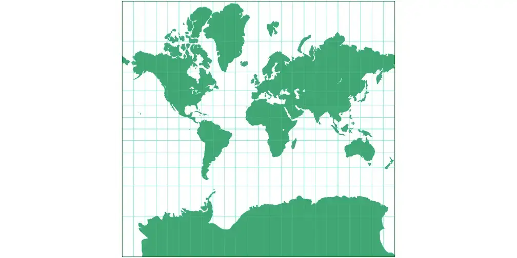
Old Map
The Mercator projection, created in 1569 by Gerardus Mercator, a Flemish mapmaker, was made for sailors to easily navigate since they could draw straight lines matching compass directions, improving sea travel accuracy.
Its practical design and rectangular format made it a staple in atlases, classrooms, and wall maps by the 19th century. However, the system that was effective for sailors also brought about a persistent issue, which was an inaccurate representation of geographical locations.
Old Map Problems
The Mercator projection stretches landmasses as they approach the poles. This makes regions like Greenland, Europe, and North America appear much larger than they are, while continents near the equator look far smaller.
- Greenland appears nearly the same size as Africa on the Mercator map. In reality, Africa is 14 times larger.
- India and tropical nations also appear much smaller than their true land area.
- Africa is compressed visually despite being the second-largest continent by both area and population.
This distortion not only affects perception but also reinforces outdated hierarchies in how the world is visually represented.
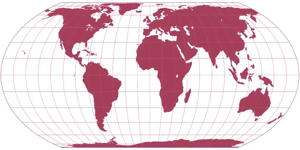
New Map: The Equal Earth Projection
The Equal Earth projection, introduced in 2018, offers a compromise between geographic accuracy and usability.
Unlike the Mercator map, it preserves the relative size of continents, showing Africa at its true scale while avoiding the extreme distortions of older alternatives.
Therefore the Correct the Map campaign advocates for Equal Earth in schools, institutions, and digital platforms.
Widespread adoption would not only improve geographic literacy but also shift perceptives toward a fairer representation of Africa.